Typhoon Haiyan
Typhoon Haiyan (Wikipedia), also known as Typhoon Yolanda, is a tropical cyclone that devastated the Philippines. It first made landfall at Guiuan, Eastern Samar on the morning of November 8, 2013, and then proceeded to Tacloban City (map), where a storm surge laid waste to much of the area. The typhoon then caused destruction in northern Cebu, Panay island, and northern Palawan before exiting the country towards Vietnam.
Jan 1st 2014, 1,670 voluntary contributors of the OpenStreetMap project from 82 countries have contributed to map for the typhoon Yolanda / Haiyan humanitarian response. They did this mainly from their home with their personal computer communicating and coordinating on the internet. The Humanitarian OpenStreetMap Team (HOT) acts as a bridge between the OpenStreetMap Community and traditional Humanitarian Responders.
OpenStreetMap offers an online map which is updated by the minute. Meanwhile various tools and services allow data extracts for GIS specialists, Routable Garmin GPS data, OSMAND, and other device-compatible downloads. With an internet connection regular syncing is possible with open access to the community contributed data as it comes in, but OpenStreetMap's bulk data downloads are ideal for use offline. Of course the maps are also printed to paper. Aid agencies such as the Red cross delivered poster-size maps to field teams.
Information about this Humanitarian Activation
HOT Updates
- 2013-11-17 OpenStreetMap Response to Typhoon Haiyan / Yolanda
- 2013-12-01 Mapping Request for Carles area (Typhoon Haiyan)
- 2013-12-05 OpenStreetMap and Yolanda: A Report from Manila
- 2013-12-17 Imagery for Haiyan
- 2014-01-14 Some editing stats from the Typhoon Haiyan response
- 2014-01-26 Support Haiyan/Yolanda Reconstruction: Contribute Public Use UaV (Drone) Imagery
History of this intervention
- Thursday 2013-11-07: The day before the Typhoon struck Tacloban city, OpenStreetMap contributors started to map the city.
- Sunday 2013-11-10: We declared an official Humanitarian Activation, which indicates that this is the highest priority for our organization and asked others to help us.
- We setup coordination with various actors including OCHA, the American Red Cross and the US State Dept Humanitarian Information Unit (HIU).
- The International Charter 'Space & Major Disasters' also activated, the various imagery providers realigning satellites to obtain post-disaster imagery.
- Our imagery specialists started to look for Imagery, adapt it and host it on servers for access by the mappers.
- We planned a revised humanitarian mapping workflow with a tagging scheme for damaged buildings and infrastructures and adaptation of the various tools to deliver appropriate maps.
- Monday 2013-11-11: The European Commission released the first post-disaster imageries of Tacloban.
- Wednesday 2013-11-13: HIU delivers Post-disaster imagery from Digital Globe and the first Post-disaster Task Manager job is available for mappers to look at damaged buildings of Tacloban.
Reactivity of the OSM Community
- Friday 2013-11-15: More then 900 OpenStreetMap mappers have contributed to this project. In a week, they have modified more than 2,000,000 objects on the map.
- Saturday 2013-11-16: At the request of the US government, for humanitarian reasons, DigitalGlobe renders public for 30 days the pre and post-disaster imageries related to the Hayian typhoon.
- 2013-11-19: Over 1,200 OpenStreetMap mappers have modified more than 3,000,000 objects for the project.
- 2013-11-24: Over 1,500 OpenStreetMap mappers have modified more than 3.8 million objects for the project.
- 2013-12-11: Over 1,600 OpenStreetMap mappers have modified more than 4.5 million objects for the project.
Tools adaptation and services
The various OSM developers communicate over internet through various communication channels. In 2013 they implemented the new Humanitarian Map Style, a map more adapted to humanitarian actions. This map, hosted by OpenStreetMap-fr, is integrated in various online map tools. For this activation, we decided to show the damaged buildings on this map and to better integrate the various paper maps in the humanitarian workflow. The developers responded quickly and we were able to deliver these maps 10 days after the typhoon.
The Tasking Manager and the JOSM editor are essential parts of this Activation. As new imagery are available, new jobs are added to the Tasking Manager. It has allowed HOT to coordinate efforts of mappers around the world. Some days there were more then 200 simultaneous mappers registered on the Task Manager and editing mainly with the JOSM editor. ID editor is also used for less intensive mapping. LearnOSM.org offers learning material for beginners and more advanced mappers.
- Monday 2013-11-11 :
- Raw OSM extracts for GIS Analysis GPS Garmin Data: Hourly updates from Dedicated Geofabrik site for Typhoon Yolanda / Haiyan.
- Various OSM Contributor statistics from neis-one.org.
- Garmin Routable GPS Map: Daily update from OSM by Schadow1 Expeditions for the whole Philippines. Compiled from OSM data until relief operations is concluded.
- Wednesday 2013-11-13:
- Navigation Offline Data for Android smartphones: Experimental hourly updated Philippines map for OsmAnd available here: http://osmd.ch/haiyan/ (install by copying to OsmAnd directory on your Android device). With limited communications in the disaster region, it is recommended to download offline data before travelling to this region.
- Paper Maps: Various field teams that start to deploy are requesting Paper maps. We recommend to people that travel to the disaster zone to print and bring paper maps with them and to download Geofabrik extracts of Routable GPS Garmin files and OSMAND offline data.
- Friday 2013-11-15: uMap Personal Online Map Service adds an option for Map overlays with Dynamic requests to external services like Xapi or Overpass. This lets extract various data from OSM (See example).
- Saturday 2013-11-16: Humanitarian Map Style is adapted for humanitarian actions. Revision is made for Damaged buildings (orange) and Collapsed buildings (red). This Humanitarian layer is integrated in various online maps. Red Cross and others are accessing the Humanitarian Map tile service hosted on OpenStreetMap-fr servers. See Harry Wood Sample Map describing how to add to an OpenLayers Online map.
- Monday 2013-11-18: 10 days after the typhoon, Humanitarian Map Style is available with tools such as
- FieldPapers Paper Maps with grid for field survey,
- MapOSMatic Large Paper Maps with grid, street index and POI and
- Osmose Validation / Correction tool.
With the Humanitarian style integrated, these three tools show the buildings damaged or destroyed. Better field survey and quality control is possible. We have produced in coordination with the Red Cross detailed maps that help identify infrastructure at risk and severely affected areas. Navigation Products extracted from the OSM database are also facilitating field teams road navigation in the region. Updates to the OSM database are immediately reflected on the maps and in the various Data extracts available.
Coordination
Andrew Buck, assisted by Maning Sambale and Pierre Béland, are coordinating this activation. We coordinate with the Red Cross and the Digital Humanitarian Network. Regions requiring mapping are coordinated through the use of the HOT Tasking Manager.
Support Team
Contributors from 82 countries collaborate to this Activation through internet. In such a context, various communication medias are used to coordinate. The support team communicates via the irc://irc.oftc.net #hot IRC channel. You can join the Support Team and the Coordinators on the IRC for discussions or help for mapping. You can also talk with other mappers or the support team by installing mumble and connecting to our server talk.hotosm.org
Public e-mail communication among HOT Team members can be found at Humanitarian OSM Team (HOT) Mailling-List. The first posting was "Preparations for Typhoon Haiyan" which appeared the day before landfall. Thereafter, the majority of posts to the e-mail list in November 2013 related in some way to the typhoon response.
Effort made
With the dispersion of the population in numerous islands and with the extent of the damages, Up-to-Date maps is an essential aspect of the management of this crisis. Tremendous efforts have been made by the OpenStreetMap community. The developers are adapting tools to provide up-to-date maps rapidly to humanitarian field workers. Hundred of contributors are also tracing over Satellite imagery to update continuously the maps.
Free Maps - Web, Paper, GPS, Smartphone, Data, Shape files for GIS analysis
General Info
OpenStreetMap (OSM) provides good mapping data for this country (free!)
Browse the map to get a feel for the data we have available. Different map styles can be selected on the right side.
See Downloading data for instructions on getting large scale map data. See Shapefiles if you need this format.
On-site maps
- Raw OSM extracts for GIS Analysis GPS Garmin Data: Hourly updates from Dedicated Geofabrik site for Typhoon Yolanda / Haiyan.
- Various OSM Contributor statistics from neis-one.org.
- Garmin Routable GPS Map: Daily update from OSM by Schadow1 Expeditions for the whole Philippines. Compiled from OSM data until relief operations is concluded.
- Navigation Offline Data for Android smartphones: Experimental hourly updated Philippines map for OsmAnd available here: http://osmd.ch/haiyan/ (install by copying to OsmAnd directory on your Android device). With limited communications in the disaster region, it is recommended to download offline data before travelling to this region.
- Paper Maps: Various field teams that start to deploy are requesting Paper maps. We recommend to people that travel to the disaster zone to print and bring paper maps with them and to download Geofabrik extracts of Routable GPS Garmin files and OSMAND offline data.
- uMap Personal Online Map Service adds an option for Map overlays with Dynamic requests to external services like Xapi or Overpass. This lets extract various data from OSM (See example).
- Humanitarian Map Style adapted for humanitarian actions. It highlights Damaged buildings (orange) and Collapsed buildings (red). This Humanitarian layer is integrated in various online maps. Red Cross and others are accessing the Humanitarian Map tile service hosted on OpenStreetMap-fr servers. See Harry Wood Sample Map describing how to add to an OpenLayers Online map.
- FieldPapers Paper Maps with grid for field survey,
- MapOSMatic Large Paper Maps with grid, street index and POI and
- Osmose Validation / Correction tool.
- A Tile Server with layers for critical infrastructure elements at risk and the residential population distribution in the Philipines in 90m resolution. Further details here
Usage of OSM data for Humanitarian Missions
Using JOSM, Garmin Basecamp and OSM-PH Garmin map based on OSM Data for Humanitarian mission planning Schadow1 Expeditions Guide
How you can contribute to this activation
Response maps
A Map which shows the damaged buildings in Tacloban.
A CrisisMap which shows "Elements at risk" based on OSM as well as damaged buildings and blocked roads for the Phillipines. Further layers include population density and instagram images. http://crisismap.geog.uni-heidelberg.de/.
Mapping response
The first week of this Activation, intense work was done by OSM contributors to update the base map for the affected zones using pre-Disaster Imagery (mostly Bing Imagery). From, Nov 14 2013, Post-Disaster imagery from various providers started to be available. As these imagery arrive, new tasks will be added. Your help is welcomed for remote mapping and is essential for a rapid response and the success of this operation.
Tacloban City, Leyte (population: ~220,000) has been hit hard. Important Relief efforts will be localised there. New reports indicate international and local aid workers are beginning to arrive. We have already pretty much mapped every building in the city based on pre-typhoon Bing imagery (second-pass validation is always welcome mind you). Other mapping areas are laid out in various task manager jobs :
| Job No. | Location | What to map | Imagery expiration | Task Mapping Status | Task Validation Status |
|---|---|---|---|---|---|
| Job 338 | Tacloban City and surrounding areas | detailed buildings and roads | N/A | Complete | Discontinued |
| Job 339 | Samar and Leyte | villages and major roads | N/A | Complete | In Progress |
| Job 340 | Priority areas in Cebu, Leyte, and Samar | detailed buildings and roads | N/A | Complete | In Progress |
| Job 342 | Bantayan Island | detailed buildings and roads | N/A | Complete | In Progress |
| Job 343 | Camotes Islands | detailed buildings and roads | N/A | Complete | Complete |
| Job 344 | Roxas City and surrounding areas | detailed buildings and roads | N/A | Complete | In Progress |
| Job 345 | northern Negros | detailed buildings and roads | N/A | Complete | In Progress |
| Job 346 | northern Panay | detailed buildings and roads | N/A | Complete | In Progress |
| Job 347 | northern Cebu | detailed buildings and roads | N/A | Complete | Complete |
| Job 348 | Coron, Palawan | detailed buildings and roads | N/A | Complete | In Progress |
| Job 349 | Masbate Island Roads | Major roads and smaller interconnecting roads | N/A | Complete | In Progress |
| Job 351 | Ormoc City | buildings, infrastructure, areas, natural features and other important visible features | N/A | Complete | In Progress |
| Job 350 | Tacloban Post-Disaster | Building and infrastructure damages | N/A | Complete | In Progress |
| Job 375 | Carles Municipality Pre-Disaster Tracing | The REACH Initiative will be sending trained enumerators to conduct detailed shelter surveys in a sample of municipalities affected by Typhoon Haiyan. One of these municipalities is Carles. | N/A | Complete | Complete |
| Job 356 | Roxas City Post-Disaster | Building and infrastructure damages, updates for previously not covered areas | TBD | Complete | Discontinued |
| Job 360 | Northern Cebu - Post Disaster | "base mapping" buildings (ok/collapsed/damage),streets | TBD | In Progress | In Progress |
| Job 361 | Inland Negros island | detailed buildings and roads | TBD | In Progress | In Progress |
| Job 1001 | DigitalGlobe post typhoon imagery | detailed buildings and roads | TBD | In Progress | In Progress |
| Job 1002 | Landsat Roads, Rivers, and Villages | New Landsat8 imagery can be used for tracing roads and residential areas | TBD | In Progress | In Progress |
| Job 1003 | Basemapping from DigitalGlobe Crisis Imagery | Extend remote mapping to other parts of the country which has DigitalGlobe imagery. | TBD | In Progress | In Progress |
| Job 364 | Panay Island Eastern Side Initial Mapping | Improve data in Eastern Panay. | TBD | In Progress | In Progress |
| Job 366 | Northern Leyte - Post Disaster | We are missing pre disaster bing imagery in this area, but there is ok (very cloudy) post disaster imagery for this area. | TBD | In Progress | In Progress |
| Job 392 | Carles Municipality Post-Disaster Assessment | Assess the state of damages in this area to better target disaster assistance | TBD | In Progress | In Progress |
Beyond these, we need experienced mappers to make assessments of missing data on a wider scale. Improvements to coastline, and fix up of place names is needed.
WikiProject Philippines pages probably could use some updating. These notes on Bing alignment may be of interest.
Damaged buildings assessment
See the Damaged buildings crisis mapping for more details
Here is a guide on useful tools and shortcuts for tracing buildings in josm. It is highly recommended you take the time to learn to do this well as it will make it much easier for you to contribute to the map. Google doc
Todo: Just a summary of tagging and visualisation tricks should go here
Available Imagery
How to add to JOSM
It's easy to add special imagery to JOSM from the task manager jobs, where an imagery URL is provided within the task manager. Clicking the URL should trigger JOSM remote control to add the new imagery as a layer. For more details see OSM Tasking Manager/Setting up JOSM
Bing
Bing is the basic Imagery available for OSM. It provides high-res Imagery for most of the affected areas. However, other high-res imageries are sometime used for areas where more recent imagery is provided.
DigitalGlobe
In support of Operation Damayan, the US Government has requested that DigitalGlobe imagery be temporarily released and licensed to the public for humanitarian purposes.
This imagery is available under the NextView licence for 30 days, starting on Nov. 16, 2013. (It appears that this period of time could be renewed, depending on operational need, according to this tweet).
To use it for mapping, go to http://tasks2.hotosm.org/job/1003 , Workflow tab, read and agree to the NextView licence, and click on the given wms: URL in the Workflow tab.
(You may also have to copy/paste the wms URL manually into JOSM preferences)
Humanitarian Information Unit set up a service for North Cebu post-disaster image as TMS: http://hiu-maps.net/hot/1.0.0/cebu-post-flipped/{zoom}/{x}/{y}.png
TMS and WMS services for priority areas are also hosted on OSM France servers, under NextView license (unlimited in time), as described in these posts: https://lists.openstreetmap.org/pipermail/talk-ph/2013-December/004884.html
https://lists.openstreetmap.org/pipermail/talk-ph/2013-December/004896.html
CNES - Astrium
For the first time in the history of the International Charter Space and Major Disasters, CNES and Astrium, producer and distributor, released the Pleiades images acquired within the Charter under a free license.
The raw imagery files are available online on a public ftp server, for whichever innovative use you may see fit to support disaster and recovery efforts: ftp://ftp.astrium-geo.com/Philippines/
You can for example print them on paper for wall posters, or for quick paper maps to walk around damaged areas with a view from the sky, to go navigate in the field on a road network riddled with fallen trees, etc, etc, etc...
Tacloban Pleiades-1 image was used for example to produce post-disaster high resolution imagery atlases of Tacloban City, Palo and Santa Fe municipalities, with a pdf map for each barangay or village, on request from responders in Tacloban who wanted to plan the relief work of NGOs: http://wms.openstreetmap.fr/philippines-yolandaph-pleiades/
Esri hosts web services:
http://disasterresponse.maps.arcgis.com/home/item.html?id=3f6a9b3cf73642c28071b67efec4cd04
that include the following TMS URL for Roxas image: http://tiles.arcgis.com/tiles/DO4gTjwJVIJ7O9Ca/arcgis/rest/services/Philippines_Pleiades1_11nov13/MapServer/tile/{zoom}/{y}/{x}
and, for Tacloban image: http://tiles{switch:1,2,3,4}.arcgis.com/tiles/DO4gTjwJVIJ7O9Ca/arcgis/rest/services/ph_v2/MapServer/tile/{zoom}/{y}/{x}
Landsat 8 and 7
Pre- and Post-Disaster Landsat (8 and 7) over the most affected area :
- Pre-disaster Landsat-8 coverage over the Charter activation perimeter (13 images) :
JOSM TMS URL: tms[19]:http://imagery.openstreetmap.fr/tms/1.0.0/haiyan_ls8/{zoom}/{x}/{y}
source=Landsat-8, NASA, USGS, 2013
- Post-disaster Landsat-8 images (5 images) :
JOSM TMS URL: tms[19]:http://imagery.openstreetmap.fr/tms/1.0.0/haiyan_ls8_post/{zoom}/{x}/{y}
source=Landsat-8, NASA, USGS, 20131112-14
- Post-disaster Landsat-7 images (3 images) :
JOSM TMS URL: tms[19]:http://imagery.openstreetmap.fr/tms/1.0.0/haiyan_ls7_post/{zoom}/{x}/{y}
source=Landsat-7, NASA, USGS, 20131113
- Post-disaster Landsat-8 images, taken on 2013-11-21 (2 images) :
JOSM TMS URL: tms[19]:http://imagery.openstreetmap.fr/tms/1.0.0/haiyan_ls8_20131121/{zoom}/{x}/{y}
source=Landsat-8, NASA, USGS, 20131121
- A WMS service giving individual access to all of the above images, and a few more, is also available, for example to juggle between images taken at different dates at the same location, and thus different cloud configurations. See https://lists.openstreetmap.org/pipermail/talk-ph/2013-November/004773.html for how-to-use instructions, and its thread for more details.
- Landsat Imagery (15 meter resolution, many clouds, contrast already enhanced for tracing) is provided for some areas. It can help to trace roads in areas with no high-res or covered by clouds. See description at https://gist.github.com/celoyd/7408773 (includes links to browse views to see footprint).
Leyte (PH LEY)
iD:
- https://d.tiles.mapbox.com/v3/char.Leyte1/{z}/{x}/{y}.png (Open)
- https://d.tiles.mapbox.com/v3/char.Leyte2/{z}/{x}/{y}.png (Open)
JOSM:
N Panay/S Masbate region, including Roxas, Cadiz, and Bogo Cities
iD:
- https://d.tiles.mapbox.com/v3/char.Yolanda3/{z}/{x}/{y}.png (Open)
- https://d.tiles.mapbox.com/v3/char.Yolanda4/{z}/{x}/{y}.png (Open)
JOSM:
Enhancing Bing Imagery
Since the Bing Imagery is partly low contrast you might wish to enhance it. An ancient JOSM binary exists with which you can do so, but a lot of plugins don't work with it anymore - buildings-tools amongst them. Go here for details: Enhance Imagery.
Potential Datasources
Kate Chapman is investigating the licensing of place codes and ways to link them to OSM data. Currently this investigation is going through OCHA (Office for the Coordination of Humanitarian Affairs, part of the United Nations Secretariat).
Historical Maps
Maps provided by the University of Texas, rectified with NYPL's Mapwarper tool.
iD:
- Entire Affected Region, 250k: http://mapwarper.net/layers/tile/111/{z}/{x}/{y}.png (Open)
- Selected Cities: http://mapwarper.net/layers/tile/113/{z}/{x}/{y}.png (Open)
JOSM:
- Entire Affected Region, 250k: http://mapwarper.net/layers/tile/111/{zoom}/{x}/{y}.png (Add via remote control)
- Selected Cities: http://mapwarper.net/layers/tile/113/{zoom}/{x}/{y}.png (Add via remote control)
News about this Activation for Typhoon Haiyan
Mapathon events
In some parts of the world people are organising mapathons events, where you can meet with mappers in person. This is an opportunity to meet-like minded pro-mappers, learn how to contribute to OpenStreetMap if you're new to it. Other events are more generic, on any technology for crisis response, by can (should!) have a bunch of people doing stuff for OpenStreetMap. Upcoming events are listed below. quietos_C%C3%B3rdoba Córdoba (Spain)] - Wednesday, 4 December
Please link to more details for these events
Past Events
- 2013-11-13 UP Diliman, Philippines hosted by the University of the Philippines Geography Department - . FB Photos
- 2013-11-14--15 Kathmandu Living Labs and OSM-Nepal -
- 2013-11-14 Heidelberg (University GIScience Group)
- 2013-11-14 Seville, Spain
- 2013-11-14 London - on eventbrite - harry diary Sam Leach blog ODI blog
- 2013-11-15 Valencia wiki page (beCode offices)
- 2013-11-16 Zagreb - Faculty of Geodesy - Saturday (Room 64) - starts @13:00
- 2013-11-16 Graz - CrisisCamp Graz, Saturday
- 2013-11-16 CrisisCampDC - Saturday
- 2013-11-16 Managua, Nicaragua - Saturday (co-labora) - 9am to 4pm
- 2013-11-16 Vermont, USA
- 2013-11-17 Tokyo - http://connpass.com/event/4005/ - Sunday
- 2013-11-18--21 Heidelberg - Monday to Thursday - several groups, (University GIScience Group), whole week continuation of Mapathon started on Nov. 14. over 200 Geography students in total. NEW additional MUNCH (Mapping Breakfast) on 2013-11-22, Friday
- 2013-11-18--22 London, Moorgate, 9:30 - 5:30 with the British Red Cross GIS team
- 2013-11-22 Nairobi(Kenya) - Friday at the International Conference of CrisisMappers ()
- 2013-11-22 Valencia - Fri (UPV lab)
- 2013-11-22 Paris - Fri, 18:00-22:00 at La Fonderie more details on https://openstreetmap.fr/2013-11-22-reunion-osm-parisienne
- 2013-11-22 Paris - Fri, 18:00 CartOng at la Fonderie and remote mapping http://cartong.org/volunteers/blog/participation-au-maphathon-osm-%C3%A0-la-fonderie-pour-aider-%C3%A0-cartographier-les-zones
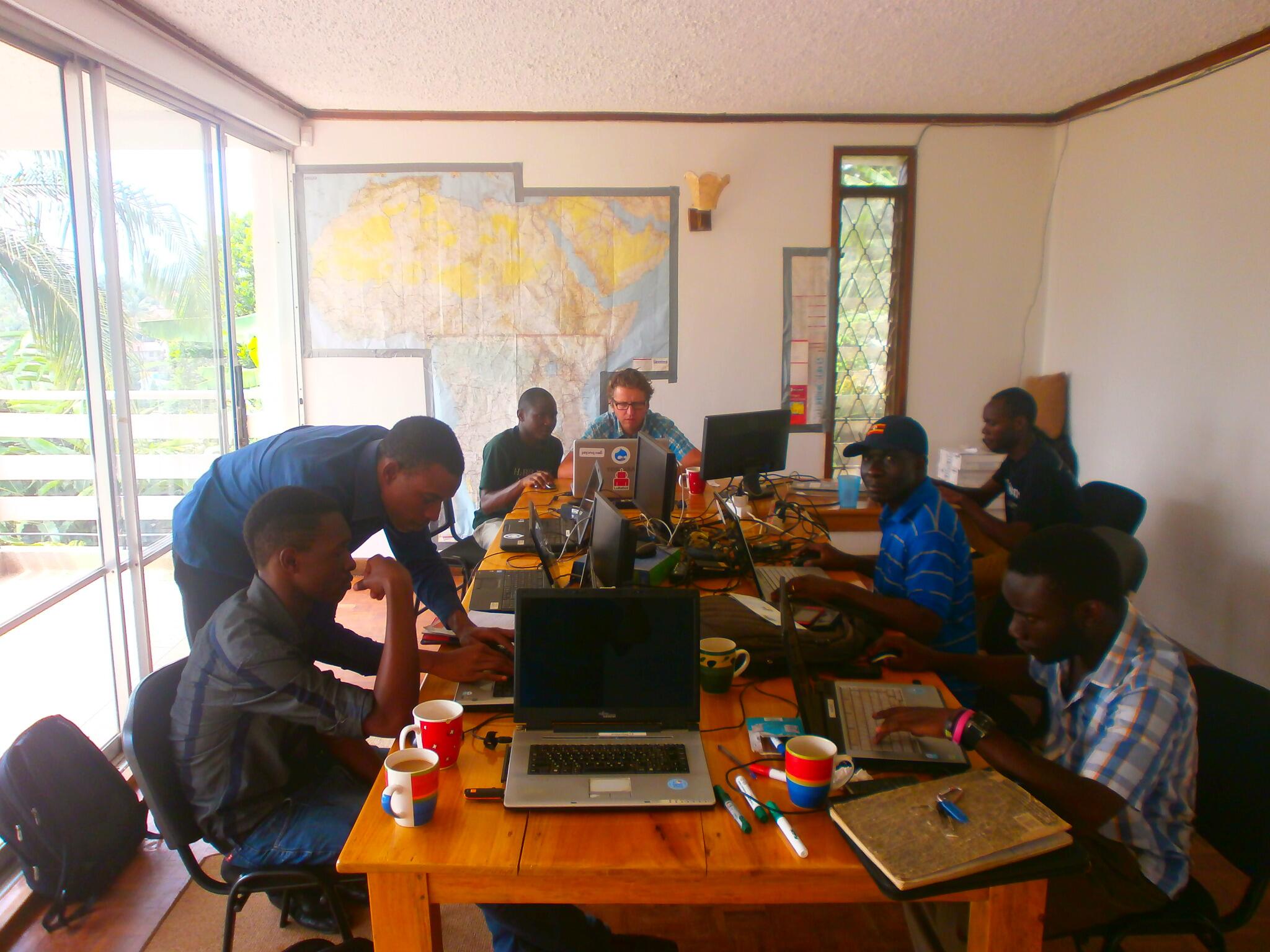
- 2013-11-23 Kapala, Uganda, (photo, tweet) refer to Muyenga, Kampala 2013-11-23, 9:30 - 3:00 with (Mapping day Uganda)
- 2013-11-23 UP Diliman, Philippines hosted by the University of the Philippines Geodetic Engineering Department, CWTS EnggGE - Sat, 9:00 AM - 5:00 PM
- 2013-11-23 Quebec city OSM local group
- 2013-12-04 Córdoba (Spain)
Contributor Statistics for this Activation
- neis-one Map of changesets
- neis-one Map of changesets for specific hashtag We simply add a hashtag in the Comment when uploading (example comment=#mapathonxxx Task manager job yyy)
- neis-one Contributors and Map changes To date
- neis-one Contributors country
- OSMstats Philippines active members an note created per day
Media coverage
English
- Schadow1 Expeditions PH blog - Super Typhoon Yolanda, the Philippines and the Mapping Advocates - 11th Nov. Write up of various ways to help and damage report and links to tasks.
- GeoAwesome Team - Typhoon Haiyan: how crisis mapping works! - 11th Nov.
- The Atlantic - How Online Mapmakers Are Helping the Red Cross Save Lives in the Philippines - 12th Nov - Lengthy write up including details from Dale Kunce of the Red Cross.
- New Scientist - Social media helps aid efforts after typhoon Haiyan - 12th Nov
- KCRW, To The Point, PRI - The Race to Provide Typhoon Relief Aid to the Philippines (minute 41:32) - 12th Nov
- New York Times - Mapping the Destruction of Typhoon Haiyan - 11th Nov (use of OpenStreetMap)
- BBC Technology blog: Rush to get Tacloban hospital online - 13th Nov - small mention
- BBC World service. World Business News (radio) - 13 Nov - Short interview with Harry Wood (minute 6:23)
- techpresident.com - Red Cross Relies on OpenStreetMap in Haiyan Relief Efforts - 13th Nov
- Wired UK - How the Red Cross and digital volunteers are mapping Typhoon Haiyan to save lives - 13 Nov
- ITWeb (ZA) - Tech aids Philippines disaster relief - 13 Nov
- Remote Mappers Enable Relief to Reach Philippines Typhoon Victims - 13th Nov
- Choose Philippines - Super Typhoon Yolanda, the Philippines and the Mapping Advocates - 12th Nov (Special for Voluntourism)
- The Guardian: Online volunteers map Philippines after typhoon Haiyan - 15th Nov
- WBUR, NPR, Here and Now - Crowdsource Mapping Helps Recovery Efforts In Philippines - 15th Nov
- World Bank: OpenStreetMap volunteers map Typhoon Haiyan-affected areas to support Philippines relief and recovery efforts - 15th Nov
- TechCocktail - DC Tech Responds to Typhoon Yolanda/Haiyan with CrisisCamp Philippines - 15th Nov
- ReliefWeb - OpenStreetMap volunteers map Typhoon Haiyan-affected areas to support Philippines relief and recovery efforts - 15th Nov
- Indiana University Bloomington - Mapping Typhoon Hayan - 15th Nov
- NPR Weekend Edition - Connecting To The Internet, And The World, Post-Disaster
- OpenHealth News - OpenStreetMap Response To Typhoon Haiyan / Yolanda - 17th Nov
- GISciences News blog - Impressions and results from Haiyan Crisis Mapathon at Heidelberg University - 17th Nov (Andrew Buck Remote Presentation to 200 students + plus participation of these students to mapping)
- GISUser - Typhoon Haiyan Volunteer Mappers Update: CrisisMap from Heidelberg University - 18th Nov
- Schadow1 Expeditions - Maps at Work. Typhoon Haiyan and the Worldwide Mapping Effort - 18th Nov
- Aljazeera - Digital drive aids Philippines relief - 18th Nov
- Scientific American - Crowdsourcing Goes Mainstream in Typhoon Haiyan Response - 20th Nov
- Nature - Crowdsourcing goes mainstream in typhoon response - 20th Nov
- GIM International - Volunteer OpenStreetMap Contributors Add Data After Typhoon Haiyan - 20th Nov
- Vermonters Help the Philippines Relief Effort with Digital Map Making - 20th Nov
- Environmental Prose, Typhoon Haiyan strikes the Philippines – Mapping technology supports relief efforts (Part 2) - 22th Nov
- PennState Dept. of Geography - Student’s research leads to humanitarian mapping work - 25th Nov
- Innocentive - The Impact of Crowdsourcing on Typhoon Haiyan Response - 25th Nov
- Digitizing Disaster: Red Cross Taps Online Mapmakers to Help the Philippines - 02nd Dec
- ReliefWeb, Red Cross - Mapping team explores new territory in wake of Typhoon Haiyan - 02nd Dec
- Operational and Delivery Networks, by Mahsa Hedayati, Global Solution Network, 07th Apr. 2014
- The Take Away, Digital Volunteers Map Destruction in the Philippines - 12th Dec
French
- JerryPlanisphere, OpenStreetMap se mobilise après le typhon Yolanda (Haiyan) - 12 Nov
- Framablog, Quand la communauté OpenStreetMap aide à sauver des vies aux Philippines - 13 Nov
- Contrepoints, Mapping de crise suite au typhon Haiyan - 13 Nov
- Libération, Cartographie de crise aux Philippines - 14 Nov
- GeoAnalyse.net, Typhon Haiyan aux Philippines: participation à l’effort de cartographie - 18 Nov
- Neogis.ca, Une mise à jour cartographique collaborative des Philippines à l’aide d’OpenStreetMap 2 Dec
- Reportage TV5 Monde
Italian
Dutch
German
- Wie OpenStreetMap helfen kann! - Typhoon Haiyan 2013 -13th Nov
- Krisen-Hilfe aus dem Netz Crisis Mapping - 13st Nov
- Die Spur des Bösen: Philippinen-Katastrophe, Teil 1 -14th Nov
- Die Spur des Bösen: Philippinen-Katastrophe, Teil 2 -15th Nov
- Crisis Mapping hilft bei Katastrophen -18th Nov
- Von Heidelberg aus im Krisengebiet helfen - 18th Nov
- Was blieb stehen? Freiwillige aktualisieren Landkarten der philippinischen Krisenregion. Für die Helfer vor Ort ist das oft lebenswichtig. ZEIT Online - 21st Nov
- Zwei Saarländer weisen Katastrophenhelfern den Weg In. Saarbrücker Zeitung - 11th Dec
Videos
The following are videos about the Haiyan Activation:
- Tacloban mapping [video] from Derick Rethans
- Recent HOT Activity in Philippines - Editing the Map [video] from Cartodb
- Inside the Eye of a HOT activation (Dale Kunce, American Red Cross at State of the Map US (April 2014)) [Video]
- Libération, émission 56kast - Cartographie de crise à 10:50 - 4 fev. 2014
Other Responses including Digital Humanitarian Network
- #YolandaPH - Twitter/etc hashtag
- #mapPHL - Twitter/etc hashtag for Philippine mapping efforts
- #PrayYolanda Response Team in Panay using HOT Mapping http://yachtvalhalla.net/pray/pray.htm (P.R.A.Y. Official Web Site)
- http://giscorps.maps.arcgis.com/apps/OnePane/basicviewer/index.html?appid=cf6031322a334cc3bfe3f9a74f23b384 (UNOCHA/Digital Humanitarian Network, uses OSM Base Layer)
- https://haiyan.crowdmap.com/ (VISOV activated, uses OSM as a base layer)
- https://giscorps.maps.arcgis.com/home/webmap/viewer.html?useExisting=1 (GISCorps)
- http://google.org/crisismap/a/gmail.com/TyphoonYolanda
- http://www.rappler.com/rich-media/43307-yolandaph-map-relief-needs-operation-centers
- http://www.rappler.com/rich-media/43075-yolandaph-help-map-criticial-report-agos
- http://disaster.dswd.gov.ph/maps.php (Philippines 'Department of Social Welfare and Development' Disaster Mitigation and Response Situation Map, uses OSM as base layer)
Other Links
- Voluntary Mapping Contributions to the Typhoon Haiyan Project
- Watch live OpenstreetMap mappers editing in the Philippines
- Médecins du monde - Cartographie de crise aux Philippines 17 nov
- Aljazeera - Digital drive aids Philippines relief - 18th Nov
- Palentir Technology - How we’re building an information infrastructure for Typhoon Haiyan response operations- 18th Nov - A Palentir instance to integrate OCHA reports - Mapaction updates - OpenStreetMap
- RPubs - Open Street Map: loading, analysing and visualising free maps with R and QGIS
- AllStatR R(package): Mapping Super Typhoon Yolanda (Haiyan) Track - 24th Nov
- E-Education Lessons - OpenStreetMap and its use as open data
- UN-FAO - Rice seed distribution after the typhoon Haiyan (OpenStreetMap basemap)
- Resources & sources for Typhoon Haiyan ( Yolanda) by Ontario, Canada Geographic educators, Nov 11 2013