Project of the week/2011/Jan 05
Police stations
When you need to find a police station, you need to find it Right Now! The Project of the Week is to map your local police station.
Tagging suggestions
Police stations can be mapped as a node or an area.
Required tags
The only required tags for a police station are
Optional tags
Add the operator tag to describe the police department details.
- operator=* #Examples: Los Angeles Police Department, Ohio State Highway Patrol, Royal Canadian Mounted Police, etc.
Name
- name=Davidwache If the policestation has a name.
Add addressing information for the police station as well.
Wheelchair accessible?
- wheelchair=yes/no/limited Usually police buildings need to be accessible for everybody.
Surrounding amenities
Are there stops of public transportation around?
Are related amenities around the police station? Does the station also serve as a drop-off location for a local food bank or other social agency?
Is the police station co-located with a fire station, ambulance or paramedic station? Add those as well!
Results
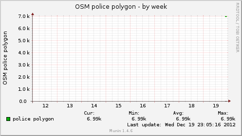
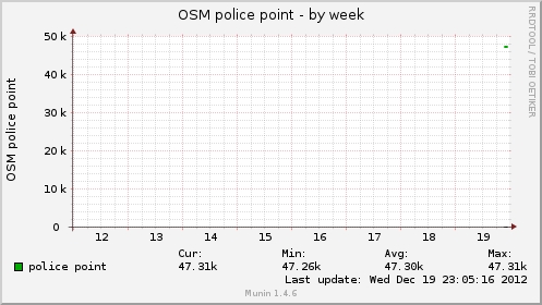
These graphs show the number of police station points and polygons in the OpenStreetMap data base. The graphs are updated about once per hour.
http://rweait.dev.openstreetmap.org/osmpolicepol-week.png
http://rweait.dev.openstreetmap.org/osmpolicept-week.png