Valencia Rendering Rules
This page describes a historic artifact in the history of OpenStreetMap. It does not reflect the current situation, but instead documents the historical concepts, issues, or ideas.
These rules have been used to render the map hosted at: http://robotica.uv.es/~jjordan/callejero
This map demonstrates the customization of OSM by means of Kosmos. Different widths have been chosen for each highway category, increasing from pedestrian to motorway, while the range of colors of OSM has been limited to white, yellow and blue. Icons for subway stations have been provided.
Rendering Rules
| Rule Name | Targets | Selector | Template | Options | Comment |
|---|---|---|---|---|---|
| Wood | natural=wood | Polygon (Color=#99DB9C) | |||
| Fell | natural=fell | Polygon (Color=#CDDB69) | |||
| Farm | landuse=farm | Polygon (Color=#EFDD8B) | |||
| Residential | landuse=residential | Polygon (Color=#DCDCDC) | |||
| Industrial | landuse=industrial | Polygon (Color=#FEADB8) | |||
| Commercial | landuse=commercial | Polygon (Color=#EFC8C8) | |||
| Retail | landuse=retail | Polygon (Color=#F0DADA) | |||
| Reservoir | landuse=reservoir | Polygon (Color=#B5D0D0) | |||
| Forest | landuse=forest | Polygon (Color=#CFECA8) | |||
| Cemetery | landuse=cemetery | Polygon (Color=#A9CAAE, BackgroundColor=#75AC7D, HatchStyle=DashedVertical) | |||
| Allotments | landuse=allotments | Polygon (Color=#C8B084) | |||
| School | amenity=school | Polygon (Color=#F0F0D8) | |||
| SchoolText | amenity=school | Text (MinZoom=15, Color=black, TagToUse=name, FontName=Times New Roman, FontStyle=bold, FontSize=15:6;17:10, TextMode=AreaCenter) | |||
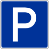
| ParkingArea | amenity=parking | Polygon (Color=#F6EEB7) | |||
| Skiing | sport=skiing | Polygon (Color=#CDDB69) | |||
| Park | leisure=park | Polygon (Color=#C7F1A3) | |||
| Pitch | leisure=pitch | Polygon (Color=#8AD2AE) | |||
| GolfCourse | leisure=golf_course | Polygon (Color=#7CCC7C) | |||
| Common | leisure=common | Polygon (Color=#CFECA8) | |||
| BuildingResidential | building=residential | Polygon (MinZoom=12, Color=#F3D6B6, BorderColor=#6B5B8E, BorderWidth=1) | |||
| Runway | aeroway=runway | Polyline (MinZoom=11, Color=#BBBBCC, Width=11:1;17:30) | |||
| Taxiway | aeroway=taxiway | Polyline (MinZoom=12, Color=#BBBBCC, Width=12:1;17:10) | |||
| ContoursMajor | IsTaggedWith(e,"ele") AND ValueNum(e,"ele") % 100 = 0 | Polyline (MinZoom=11, Color=#B0AD8852, Width=11:1;12:2, Curved=true) | for elevation contours generated by Srtm2Osm | ||
| ContoursMinor | IsTaggedWith(e,"ele") AND ValueNum(e,"ele") % 100 <> 0 | Polyline (MinZoom=12, Color=#B0AD8852, Width=1, Curved=true) | for elevation contours generated by Srtm2Osm | ||
| Water | natural=water | Polygon (Color=lightblue) | |||
| River | waterway=river | Polyline (MinZoom=5, Color=lightblue, Width=5:1;17:6, Curved=true) | |||
| Drain | waterway=drain | Polyline (MinZoom=5, Color=lightblue, Width=13:1;17:6, Curved=true) | |||
| Land | natural=land | Polygon (Color=white) | |||
| HighwayFootway | highway=footway | Polyline (MinZoom=13, Color=#FFDE93, BorderColor=gray, Width=13:1;17:6) | EliminateSeams | ||
| HighwayFootwayText | highway=footway | Text (MinZoom=15, Color=black, TagToUse=name, FontName=Arial, FontStyle=regular, FontSize=15:6;17:9) | |||
| HighwayCicleway | highway=cycleway | Polyline (MinZoom=13, Color=#0202FE, DashStyle=Dash, Width=13:1;17:4) | EliminateSeams | ||
| HighwayUnclassified | highway=unclassified | Polyline (MinZoom=11, Color=white, BorderColor=gray, Width=11:1;13:3;17:14) | EliminateSeams | ||
| HighwayUnclassifiedText | highway=unclassified | Text (MinZoom=16, Color=black, TagToUse=name, FontName=Arial, FontStyle=regular, FontSize=15:6;17:9) | |||
| HighwayPedestrian | highway=pedestrian | Polyline (MinZoom=13, Color=lightgray, BorderColor=gray, Width=14:3;17:10) | EliminateSeams | ||
| HighwayPedestrianText | highway=pedestrian | Text (MinZoom=15, Color=black, TagToUse=name, FontName=Arial, FontStyle=regular, FontSize=15:6;17:9) | |||
| HighwayResidential | IsTaggedWith(e,"highway") AND (ValueString(e,"highway") = "residential") AND NOT IsTaggedWith(e,"junction") | Polyline (MinZoom=11, Color=white, BorderColor=gray, Width=11:1;13:3;17:14) | EliminateSeams | ||
| HighwayResidentialText | highway=residential | Text (MinZoom=15, Color=black, TagToUse=name, FontName=Arial, FontStyle=regular, FontSize=15:6;17:9) | |||
| HighwayResidentialRoundabout | highway=residential junction=roundabout | Polyline (MinZoom=11, Color=white, BorderColor=gray, Width=11:1;13:3;17:14, Curved=true) | EliminateSeams | ||
| HighwayTrack | highway=track | Polyline (MinZoom=11, Color=#E2E2E2, BorderColor=gray, Width=11:1;17:10) | EliminateSeams | ||
| HighwayTertiary | IsTaggedWith(e,"highway") AND (ValueString(e,"highway") = "tertiary") AND NOT IsTaggedWith(e,"junction") | Polyline (MinZoom=10, Color=white, BorderColor=gray, Width=10:1;14:9;17:18) | EliminateSeams | ||
| HighwayTertiaryText | highway=tertiary | Text (MinZoom=15, Color=black, TagToUse=name, FontName=Arial, FontStyle=regular, FontSize=15:6;17:9) | |||
| HighwayTertiaryRoundabout | highway=tertiary junction=roundabout | Polyline (MinZoom=10, Color=white, BorderColor=gray, Width=10:1;14:9;17:18, Curved=true) | EliminateSeams | ||
| HighwaySecondary | IsTaggedWith(e,"highway") AND (ValueString(e,"highway") = "secondary") AND NOT IsTaggedWith(e,"junction") | Polyline (MinZoom=8, Color=white, BorderColor=gray, Width=8:1;10:2;14:11;17:22) | EliminateSeams | ||
| HighwaySecondaryText | highway=secondary | Text (MinZoom=15, Color=black, TagToUse=name, FontName=Arial, FontStyle=regular, FontSize=15:6;17:9) | |||
| HighwaySecondaryRoundabout | highway=secondary junction=roundabout | Polyline (MinZoom=8, Color=white, BorderColor=gray, Width=8:1;10:2;14:11;17:22, Curved=true) | EliminateSeams | ||
| HighwayPrimary | IsTaggedWith(e,"highway") AND (ValueString(e,"highway") = "primary") AND NOT IsTaggedWith(e,"junction") | Polyline (MinZoom=6, Color=#feffaa, BorderColor=gray, Width=6:0;11:3;14:13;17:26) | EliminateSeams | ||
| HighwayPrimaryText | highway=primary | Text (MinZoom=15, Color=black, TagToUse=name, FontName=Arial, FontStyle=regular, FontSize=15:6;17:9) | |||
| HighwayPrimaryLink | highway=primary_link | Polyline (MinZoom=6, Color=#feffaa, BorderColor=gray, Width=6:1;14:7;17:14) | EliminateSeams | ||
| HighwayPrimaryRoundabout | highway=primary junction=roundabout | Polyline (MinZoom=6, Color=#feffaa, BorderColor=gray, Width=6:0;11:3;14:13;17:26, Curved=true) | EliminateSeams | ||
| HighwayTrunk | highway=trunk | Polyline (MinZoom=6, Color=#feffaa, BorderColor=gray, Width=6:1;14:15;17:30) | EliminateSeams | ||
| HighwayTrunkLink | highway=trunk_link | Polyline (MinZoom=6, Color=#feffaa, BorderColor=gray, Width=6:1;14:7;17:14) | EliminateSeams | ||
| HighwayMotorway | highway=motorway | Polyline (MinZoom=6, Color=#809BC0, BorderColor=gray, Width=6:1;14:12;17:26) | EliminateSeams | ||
| HighwayMotorwayLink | highway=motorway_link | Polyline (MinZoom=6, Color=#809BC0, BorderColor=gray, Width=6:1;14:7;17:14) | EliminateSeams | ||
| Rail | railway=rail | Polyline (MinZoom=6, Color=white, DashStyle=Dot, BorderColor=gray, Width=6:1;17:6) | EliminateSeams | ||
| CableCar | aerialway=cable_car | Symbol (MinZoom=12, Type=Circle, Density=30, Color=#00000000, BorderWidth=10%, BorderColor=black, Size=12:2;17:10) | |||
| DragLift | aerialway=drag_lift | Polyline (MinZoom=12, Color=black, Width=12:0.5;17:2, LineStartCap=RoundAnchor, LineEndCap=RoundAnchor) | |||
| ChairLift | aerialway=chair_lift | Polyline (MinZoom=12, Color=black, Width=12:0.5;17:2, LineStartCap=RoundAnchor, LineEndCap=RoundAnchor) | |||
| Ferry | route=ferry | Polyline (MinZoom=8, Color=darkgray, DashStyle=Dot, Width=8:0.1;17:4) | |||
| Border | boundary=administrative | Polyline (MinZoom=1, Color=black, DashStyle=DashDot, Width=1:1;9:1.5;17:6) | Temporary, there are conflicting ways of tagging borders | ||
| ParkingNode | amenity=parking | Icon (MinZoom=15, IconUrl=http://wiki.openstreetmap.org/images/7/74/Parking.png, Width=12:5;17:20) | |||
| TrafficSignals | highway=traffic_signals | Icon (MinZoom=16, IconUrl=http://wiki.openstreetmap.org/images/a/a1/Icon-highway_traffic_signals.png, Width=16:6;17:7) | |||
| RailwayStation | railway=station | Icon (MinZoom=14, IconUrl=http://wiki.openstreetmap.org/images/f/fd/Boca_metro_valencia.png, Width=14:20;17:20) | |||
| RailwayStationText | railway=station | Text (MinZoom=15, Color=black, TagToUse=name, FontName=Arial, FontStyle=regular, FontSize=15:6;17:9) | |||
| Peak | natural=peak | Symbol (Type=Triangle, MinZoom=11, Color=gray, BorderColor=black, BorderWidth=15%, Size=13:6;17:20) | |||
| PlaceCity | place=city | Text (MinZoom=7, Color=black, TagToUse=name, FontName=Trebuchet MS, FontStyle=bold, FontSize=7:10;17:30) | |||
| PlaceTown | place=town | Text (MinZoom=10, Color=black, TagToUse=name, FontName=Trebuchet MS, FontStyle=bold, FontSize=10:10;17:25) | |||
| PlaceSuburb | place=suburb | Text (MinZoom=13, Color=black, TagToUse=name, FontName=Trebuchet MS, FontStyle=bold, FontSize=13:10;17:20) | |||
| PlaceVillage | place=village | Text (MinZoom=12, Color=black, TagToUse=name, FontName=Trebuchet MS, FontStyle=bold, FontSize=12:10;17:20) |
This article is issued from Openstreetmap. The text is licensed under Creative Commons - Attribution - Sharealike. Additional terms may apply for the media files.